
|
 |
- Home
- News
- Team
- Databases
- Conferences
- Oxford Studies on the Roman Economy
- Coin Hoards of the Roman Empire Project
- Affiliated Projects
- Publications
- Bibliographies
- Working Papers
- Links

The OXREP Databases
14-05-2011 | ||||
As part of the AHRC-funded first phase of the Oxford Roman Economy Project (2005-2010), a number of large databases were compiled, including databases of the Karanis Tax Rolls, of Roman mines and quarries, of shipwrecks, and of olive oil and wine presses. Key element of the second phase of the project (2010-2013) was to make these databases available in online form for scholars, both as a research device for scholars working on issues related to the Roman economy, and as a point of reference for publications resulting from the project. The Databases The following databases are now accessible online (see also the menu on the left):
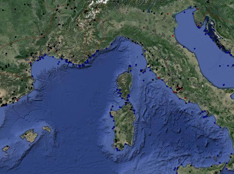
Functionality Each of the databases has a table view that can be filtered, searched and otherwise manipulated; depending on the nature of the database, it is possible to map search results, show them on a timeline, and produce a bar chart. Further, there is a general map (see picture) showing all sites in our data server of which we have coordinates, and providing links to the individual site pages – click on the dots, and an info window with a link will open. Future extensions In the near future, one major addition will be made to our data server, which is an online edition of the database accompanying the Corpus Vasorum Arettinorum. This database, which was developed by Philip Kenrick for the 2000 re-edition of the Oxé-Comfort catalogue, has been converted from its original format and has been integrated in our database system. It is currently being finalized, and expected to be released online soon. About the database server The database server, and the front-end web site was designed and built by Miko Flohr. We use a PgSQL database and a PHP-front end system. The database has a rigid core consisting of a fixed hierarchy of tables with spatial data (areas, sites, buildings), and several additional tables used to describe these data (events, keywords, references, notes). Moveable objects and texts may can be linked to the spatial hierarchy. This has the benefit of having a clear structure that allows you to put comparable data in the same table, without losing the flexibility that you need to combine a widely varying set of databases into one working system. For the maps, we use the Google Maps Api (v3).
|  |
Webdesign, databasedesign: Miko Flohr, 2010-2024. Content: OXREP, 2005-2024.